


Local officials prepare for snowstorm
Van Wert independent/EMA submission
With what is being called “a devastating winter storm” approaching Van Wert County and Ohio, local and state officials and utility companies were working hard Monday to prepare for the storm (see also stories below this article).
“I cannot emphasize the importance of being prepared for this storm, as any shift in its track could make a dramatic change in the intensity of the precipitation and the type,” County EMA Director Rick McCoy said. “But do not underestimate how bad it will be here because it’s going to get plenty bad; it’s those areas to the north and particularly south of us where it will be significant.”
At present, if the storm does not waver from its current track, Van Wert County can expect around 3 inches of snow by Tuesday morning, with 15 to 20 mph winds creating blowing and drifting of snow, McCoy said. After that first round, there should be a lull during the day on Tuesday where no precipitation falls.
The second round – and the real blockbuster storm – will arrive late this afternoon into early evening and begin as snow through the evening with another 3-4 inches of snow possible. Northeast winds of 15 to 20 mph will continue to blow the additional snowfall around, creating drifting problems, McCoy said.
But it is after midnight through early morning Wednesday that is critical, because this is when the freezing rain and sleet will move in.
“If sleet amounts remain low, then a half-inch of ice would be possible in our area,” the EMA director predicted. “But if the sleet does mix in, this will reduce the ice amounts to maybe two-tenths of an inch, which we could handle.”
Should it occur, the half-inch of ice would be a major problem, causing outages and other electrical issues when the winds kick up on Wednesday.
McCoy noted that it appears now that the precipitation will change back over to snow on Wednesday morning, with an additional 3 to 4 inches of snow possible and winds increasing from 25 to 35 mph.
The EMA director said that, with the current forecast, the county will likely see more than 10 inches of snow, plus whatever ice and sleet come with the storm.
“Travel will be hazardous, if not impossible, as we move into Wednesday,” McCoy said. “I am hoping the storm shifts a bit to the east, bringing in more snow and less ice, but, unfortunately, we just aren’t quite sure at this point.”
What is going to be historic about this storm, McCoy said, is the snowfall and ice amounts across the country. It appears now that the area north of Fort Wayne, Ind., will see snow totals of up to 24 inches, with blizzard conditions, while several counties to the south of Van Wert will receive a 1-inch ice accumulation, with areas from Indianapolis, Ind., to Dayton receiving 1½ inches of ice or more.
“It is going to be absolute destruction south of us, and though it’s going to be bad for us, we should certainly pray for the folks to our south,” he said
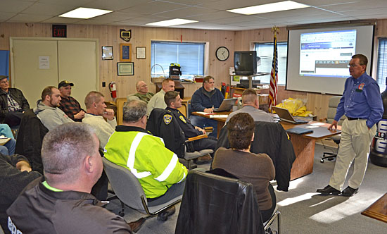
To better plan for problems resulting from the storm, McCoy held a storm preparation meeting with a number of local officials, including County Commissioners Clair Dudgeon and Thad Lichtensteiger, Van Wert Safety-Service Director Jay Fleming, County Engineer Kyle Wendel, Red Cross Executive Director Edie Laukhuf and Disaster Director Mark Klausing, Van Wert Police Chief Joel Hammond, and Van Wert Ohio State Highway Patrol post commander Lt. Ray Haas.
Discussions included the possible need for shelters, power outage issues, road conditions, emergency declarations and getting information to the public.
The issuance of timely information and announcements for the general public – and how to get that information out – is a high priority for the EMA. During the storm, statements will be made over the EMA frequency (155.805), which can be picked up by people with scanners. Local radio station WERT/WKSD (FM 99.7/AM 1220) will also be a means for getting out emergency statements at the top of the hour. McCoy advised that he also has the capability of breaking in over the radio station to put out EMA statements.
In the event that power is lost, individuals should turn on a battery-powered transistor radio or go to their vehicles at the top of each hour and tune in to WERT to see if there are emergency statements being issued.
The EMA office reminds people that county sheriffs in Ohio declare snow emergencies, while, in Indiana, each county’s Board of Commissioners make road declarations. People should adhere to the emergency declarations so as not to unnecessarily endanger themselves on roadways or impede the operation of emergency vehicles.
McCoy also noted that county commissioners in Ohio could issue a countywide emergency declaration at the request of the EMA director requesting that the public work with local officials during a disaster. Such a declaration also makes a county eligible for state and federal monies to reimburse local governments for snow removal costs. However, such declarations do not call for the closings of industry. Only the companies themselves can make that determination.
As a reminder, calls to the 9-1-1 centers should be made for actual emergencies only. People should monitor local media for general information and, if special needs arise, can all the Van Wert Chapter of the American Red Cross at 419.238.9977 or the Van Wert Emergency Management Agency at 419.238.1300.
POSTED: 02/01/11 at 3:12 am. FILED UNDER: News