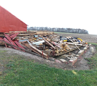
McCoy: Be prepared for severe weather
VW independent/submitted information
It’s that time of the year when the community needs to gear up and prepare for the severe weather season, said Van Wert County Emergency Management Director Rick McCoy.
Historically, severe storms start affecting the county around the second to third week of May each year. So far this spring, thunderstorms and tornadoes have been confined south of the area and also out into the plains, but that’s about to change, McCoy said.

“A change in the jet stream along with the pattern of coming out of a strong El Niño winter means stormy days ahead for the last half of May and the month of June,” McCoy noted. “If history repeats itself, strong storms will affect the area, followed by a hot, dry summer.”
In preparing for a possible active season, the EMA offers the following preparedness tips:
- Listen to local AM/FM radio for announcements.
- Those with scanners can follow EMA on frequency 155.805 MHz.
- Purchase a NOAA all-hazards weather radio for National Weather Service alerts.
- Sign up for Nixie cell phone text alerts through the Van Wert EMA website.
- Follow the EMA website at www.vanwertema.com, which shares National Weather Service radar, watch, and warning information.
- Monitor the Van Wert EMA Facebook page for weather updates.
- Listen for area sirens, which are activated when radar indicates a tornado is forming or local spotters have actually seen the tornado on the ground. Each village has a siren, Delphos has four sirens, and Van Wert has five sirens. Sirens are not used for an “all clear”. If sirens shut off, but reactivate, it means the tornado threat is still approaching.
- Know where to take shelter: If at home, go to the center of the basement. If no basement is available, go to the center of a residence in a small room such as a closet or bathroom. Residents should place as many walls between them and the tornado as possible. Cover heads and eyes with pillows or blankets. If in a mobile home, get out before a tornado strikes and go to a sturdier building. If in a church, get out of the sanctuary, as large open span roofs can collapse, and go to a basement or Sunday school rooms or restrooms. In grocery stores or large retail stores, stay clear of large open span roofs in the center of stores because of possible collapse, and go to restrooms, coolers, or other designated areas. If in a car and the tornado is still several miles away, drive quickly away from it and eventually make a right hand turn to get out of its path. If the tornado is very close, do not try to outrun it. People should get into a deep ditch or in a large culvert beneath the roadway and cover their heads with their hands.
Know weather terms:
- A WATCH means that atmospheric conditions are favorable for severe thunderstorms or tornadoes to develop.
- A WARNING means severe thunderstorms or a tornado is imminent or is already occurring.
- A SEVERE THUNDERSTORM produces winds in excess of 58mph and hail of 1 inch in diameter or larger.
- A WALL CLOUD is a lowering of a cloud on the southwest rain-free base of a thunderstorm where a funnel or tornado will develop.
- A FUNNEL CLOUD is a funnel shaped tail which is dipping up and down and spinning rapidly, but has not yet touched the ground.
- A TORNADO is a violently rotating column of air in contact with the ground and may roar like a freight train and may cause your ears to experience a popping sound as it passes. Winds may range anywhere from 60 to more than 300 mph. A majority of Ohio tornadoes move from the southwest to the northeast at a forward speed of at least 60 mph.
Before severe weather season strikes, McCoy says prepare an emergency kit that includes three days of water and non-perishable foods, a flashlight and fresh batteries, a first aid kit, extra baby food and care items, a non-electric can opener, and other necessary supplies.
POSTED: 05/11/16 at 7:56 am. FILED UNDER: News


