


Small tornado touches down near Convoy
VW independent staff and submitted information
Thunderstorms moving through Van Wert County Wednesday afternoon spawned a brief tornado in the northwestern part of the county.
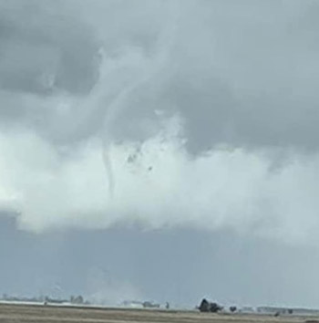
According to Emergency Management Director Rick McCoy, two different lines of storms affected the county with the second line producing a twister that briefly touched down in an open field southwest of the Elm Sugar Road and Convoy Heller Road intersection, approximately three and a half miles north of the village of Convoy.
Several local residents took pictures of the funnel prior to touching down and also of the condensation funnel as it was on the ground in the field.
The county and surrounding area was under a severe thunderstorm watch and the National Weather Service indicated the storms posed a slight risk for an isolated tornado.
McCoy said the first round of storms came through in the afternoon producing small hail and rain. It was the weaker line of storms which came through later at around 5:30 p.m. which produced the tornado.
Because it touched down in an open field and didn’t hit anything, McCoy said it was classified as an EF-U on the Enhanced Fujita scale, (wind speed unknown) tornado.
POSTED: 03/24/22 at 10:20 am. FILED UNDER: News