County spared severe storm damage
VW independent staff/submitted information
There were some unsettling moments but Van Wert County came through last Thursday’s tornado outbreak unscathed, according to Van Wert County Emergency Management Director Rick McCoy. The worst hit area in the region was just over an hour south of Van Wert, in Logan County’s Indian Lake area, including Lakeview, Russells Point and Orchard Island.
According to McCoy, the National Weather Service on Wednesday was indicating that strong to severe storms would be possible across the area and had indicated that three rounds of storms were possible starting with the first in the early morning hours of Thursday before sunrise, a second round in the late morning around the lunch hour and another round by late afternoon into early evening.

By Thursday morning, the first lines of storms went through with a lot of lightning but nothing severe. However, the National Weather Service was still pinpointing an area south of the Van Wert County line to near Greenville where the best chance for severe storms with wind, hail and possible tornadoes could occur.
The second round of storms did materialize with the National Weather Service issuing a severe thunderstorm warning for the southwestern portion of Van Wert County at 12:43 p.m. As those storms moved through, straight line winds hit the southeast corner of Wren, damaging a barn and a shed with some tree damage.
“The real problems began in the afternoon as temperatures again rose to 70 degrees with a very unstable atmosphere,” McCoy explained. “Storms began developing around Kokomo, Indiana, and quickly became tornado-warned storms. The Weather Service then issued a tornado watch for central Indiana and western Ohio.”
As storms raced across Indiana with a tornado warning continuing, McCoy activated Van Wert County Volunteer Fire Departments for storm spotting at 5:53 p.m. as storms were approaching Adams County. He also made a decision to activate the Mercer County fire departments in Chatt, Rockford and Mendon as it was becoming apparent that the severe storms would stay south of the Van Wert County line and move across central Mercer County. This ended up being the scenario that unfolded and the tornado damage was about to begin as the storm moved into Mercer County near Ohio 49, several miles south of Chatt, where the tornado began destroying some farm buildings and began a path towards Celina.
McCoy said as the tornado moved into Celina, it damaged roofs to three businesses on the east side of town including Menards, Walmart and Crowne. It also took out power to that side of town. The tornado then cut across Mercer County to the east of Celina hitting a number of farm buildings, doing extensive damage.
McCoy noted as he was watching radar that it was indicating debris from buildings in the area lofted over 7,000 feet into the air. The very strong radar signature continued into Auglaize County, still showing a tornado on the ground with debris continuing in the air. By this point, many people across Auglaize County were filming the tornado on their cell phones as it ripped through the county, destroying farm buildings and damaging homes. As it moved on the north side of St. Marys, it struck several buildings along Ohio 29 and a second tornado was hitting a number of barns and homes a half a mile north of Ohio 29.

As the storm moved towards Wapakoneta, Auglaize County EMA Director Troy Anderson was out on the road in his vehicle intercepting the storm and was able to capture several different tornadoes on video with one going through a trailer park and lifting trailers into the air showing them catching on fire.
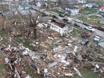
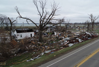
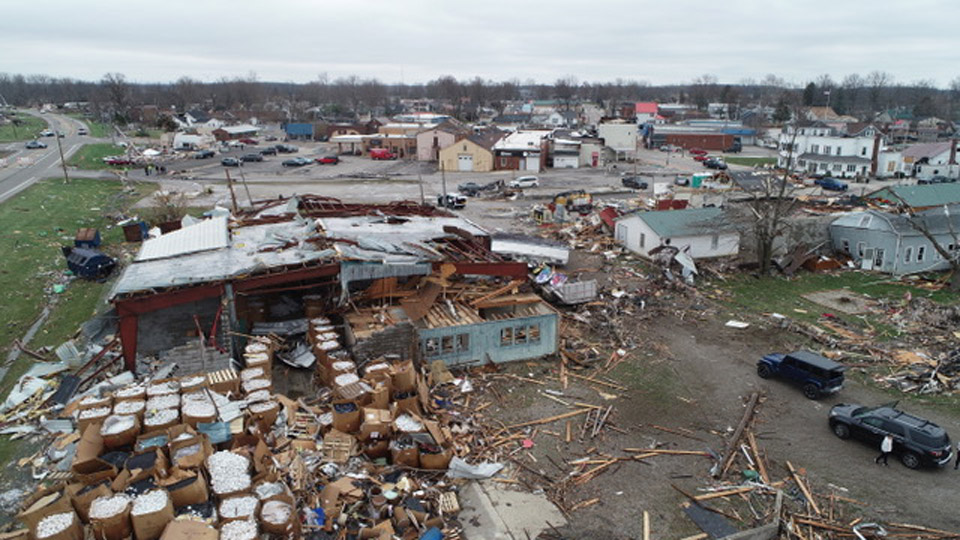
A third tornado then developed just east of Interstate 75 to the south of Wapakoneta and continued on to the east damaging numerous structures and headed toward Logan County. As this was occurring another severe storm had developed back in Indiana with a very strong tornado hitting the Muncie area and then moved into Winchester causing extensive damage to businesses and homes and injuring dozens of people. This tornado then moved into Ohio and caused heavy damage north of Greenville. During this time, the Logan County tornado had become quite large and violent and hit the Indian Lake area, including Lakeview and Russells Point on Ohio 33, and Orchard Island. Damage to trailers, campers, homes and businesses was extensive with a declaration Thursday night of a mass casualty incident.
It was also noted by National Weather Service officials that another tornado about this same time was on the ground north of U.S. 30 near Dunkirk in Hancock County.
On Friday, McCoy surveyed damage in Mercer, Auglaize and Logan counties and shared that information with National Weather Service officials and met with EMA directors to provide input on the storms. While at Indian Lake, McCoy met with Governor Mike Dewine and Lt. Governor Jon Husted and shared his assessment of the storm damage and indicated to them that damage was consistent with an EF-3 tornado, with winds up to 165 miles per hour. According to McCoy, this tornado was not as strong as the F-4 tornado that hit Van Wert in 2002, but the amount of structures damaged or destroyed was much higher.
“It literally looked like a war zone and had this happened a little later in the season when all of the campers, trailers and homes would have been full of vacationing people, the number of injuries and deaths could have been extensive,” McCoy stated.
As of Friday night a number of Injuries and four deaths had been reported at Indian Lake. Cleanup is expected to last months.
McCoy reminds local residents that tornado season has begun early this year and to always be prepared to have ways of getting the warnings and know where to go when threatening weather occurs. As was the case on Thursday, no tornado warning were issued for Van Wert County so sirens were not activated. Posts on the storm were available though on the Van Wert EMA Facebook Page and alerts were sent out to anyone locally who signed up for Nixle Alerts on their cell phone.

POSTED: 03/18/24 at 3:47 am. FILED UNDER: News


