


Van Wert slammed by storm system
SCOTT TRUXELL/independent editor
It was a quick hitting storm system but in just a matter of minutes, Van Wert experienced powerful straight line winds, a microburst and a gustnado, but no tornado.
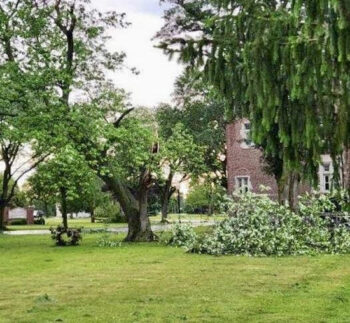
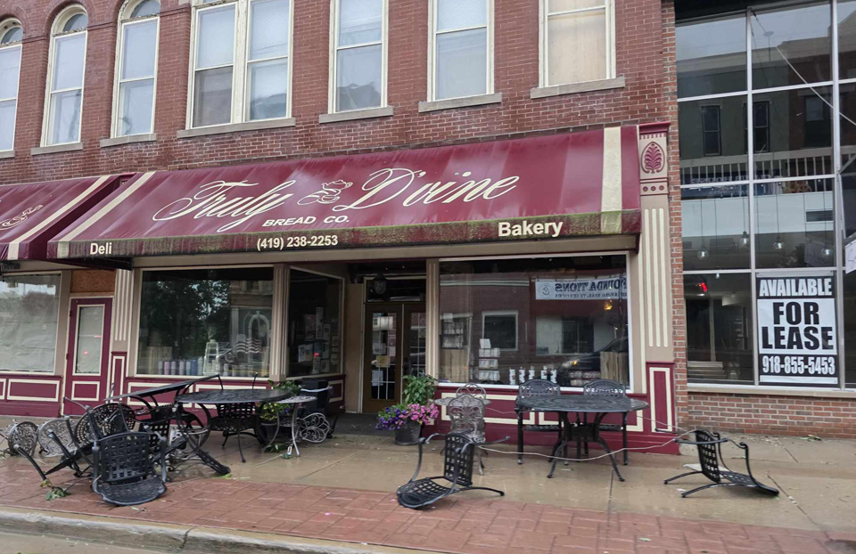
The storm left behind a wide path of damage, especially within the Van Wert city limits, prompting Van Wert County EMA Director Rick McCoy to say it’s the most damage he’s seen in the city since the June 29, 2012 derecho.
It blew into Van Wert County at approximately 6 p.m., packing high winds and intense rain for a few minutes. McCoy said the storm seemed to intensify around Liberty-Union Rd.
“It came into town and we had a wind gust at the fairgrounds of 59 miles per hour and 55 at the EMA Office,” McCoy said. “When you get 60 mile per hour winds with trees that are full of leaves, you’re going to start having damage because that wind will start twisting and snapping them. Driving around and looking at the damage afterward mostly in the city, I saw at least 100 trees that had some pretty significant damage or were destroyed.”
Trees fell on homes, garages and cars, fell across streets and roads and took down power lines, but McCoy said as of late Wednesday night, no injuries were reported. In addition, a semi-truck was blown over on U.S. 30 between Stripe Rd. and Mendon Rd.
“Drawing that line from Liberty-Union Rd. across the city to U.S. 30, there was one portion of that storm that intensified and it was clear a microburst had occurrred,” he stated. “It intensified near Washington St. just north of the jail and the whole northeast portion of the city took the brunt of that microburst.”
There was at least one report of a funnel cloud that touched down near Quail Run apartments but after reviewing video taken by a resident, McCoy determined it as actually a gustnado.
“A gustnado forms differently – it doesn’t come from a thunderstorm down but it forms from the ground up,” he explained. “When you get those 65-70 mile per hour winds going through buildings, the air will spin so fast that it will grab all the dirt, leaves and everything and spin up a funnel from the ground. You’ll have some rotation from it but it’s not really doing that much damage. There’s no indication we had an actual tornado.”
The rest of the damage in the city and the county was caused by straight line winds, including substantial damage to several trees at the Marsh Foundation.
Along with downed trees and other damage, the storm left power outages around the city, including 12 transmission poles that came down east of Vantage Career Center, along with several in front of Trinity Friends Church. Those poles feed the northern portion of Van Wert.
Before the storm hit the county and city, McCoy activated the county’s spotter network. Earlier in the day, he requested games at all ballparks in the county be canceled in anticipation of the approaching storm.
Cleanup efforts will likely take several days and McCoy said residents need to prepare for the next weather event – a heatwave that will arrive this weekend and last into next week.
“We have to watch that because we’re getting into the period of derechos, where we’ll have a multi-complex storm system that will form in the Plains and go across multiple states,” McCoy said. “It happens when we get those heat events and thunderstorms.”
POSTED: 06/18/25 at 10:34 pm. FILED UNDER: News